About Poole Orientation
(Poole, England)
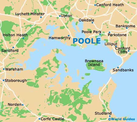
Poole stands on the southwestern coast of England, to the west of nearby Bournemouth. Perhaps most famous for its harbour, which is lined with cafés, restaurants and bars, Poole has much to offer the visitor and is just a short distance from many world-class attractions.
Poole Orientation: Layout and Directions
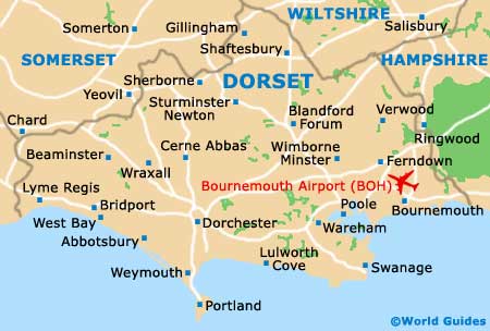
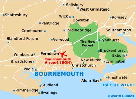
Surrounded by a number of major roads and dual-carriageways, Poole is close to the town of Ringwood and within easy reach of Bournemouth International Airport, which is just a short distance from Poole, to the northeast. Further towns nearby Poole include Boscombe, which is known for its historic pier and shops. Also within easy reach of Poole, the Sandbanks Peninsula can be reached along the B3369. Many people visiting Poole choose to travel to Brownsea Island, which stands close to the Sandbanks Peninsula and is connected by regular ferries.
In the very heart of Poole, near to the main harbour area and quayside, you will find an extensive shopping centre, with features an indoor mall and a number of notable department stores and large supermarkets.
Orientation and Map of the UK

Orientation and County Map of Dorset
Orientation and Map of Poole Area
Orientation and Map of Poole